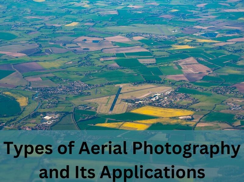
Types of Aerial Photography and Its Applications
Aerial photography is a captivating field widely utilized for diverse purposes. It is used for capturing images from an elevated position using airborne crafts like rockets, airplanes, hot air balloons, and drones. Here the image must be taken with equipment not based on the ground. Categorizing this specialized kind of photography involves considering the camera axis, image scale, and the type of film.
Table of Contents
Categories of Aerial Photography
Camera Axis
- Vertical Photographs: The camera axis is vertical, offering little relief in the image and covering a smaller area. It is commonly used for mapping purposes.
- Low Oblique Photographs: The camera axis tilts more than 3 degrees, obscuring the horizon, suitable for revealing topography and geological features.
- High Oblique Photographs: The camera axis tilts around 60 degrees, showing the horizon and providing a comprehensive view with noticeable relief.
Image Scale
- Large Scale Aerial Photographs: Captured at lower elevations, covering less area but with greater detail, beneficial for mapping land features.
- Small Scale Aerial Photographs: Taken at higher elevations, covering a larger area with less detail, suitable for studying extensive regions without requiring intricate measurements.
Film and Filter Aerial Photography
- Panchromatic Images: Grayscale film capturing all visible wavelengths, ideal for reconnaissance or map study.
- Color Photographs: Color film captures various visible bands separately, aiding in object interpretation.
- Infrared Imagery: Uses infrared film for studying vegetation and bodies of water.
- Color-Infrared Imagery: Combines color and infrared film for diverse applications like vegetation studies and water body mapping.
- Thermal Infrared Imagery: Captures infrared images and temperature variations, valuable for temperature studies.
- Radar Imagery: Captures radar waves for weather applications and tecto-morphic studies.
- Spectra-Zonal Images: Captures portions of the electromagnetic spectrum for mapping applications.
How to Take Aerial Photographs?
To snap photos from the sky, you equip a camera with a flying object like planes, choppers, hot air balloons, drones, or even kites. The camera settings can be programmed to click pictures automatically. It is operated manually by someone on the flying vehicle, or remotely controlled from a distance.
Applications of Aerial Photography
Aerial photography, an early form of remote sensing, remains a widely employed and cost-efficient technique. Its applications are diverse, including mapping, land-use planning, movie production, and environmental studies. This kind of photography is used in archaeology, power line inspection, oil and gas surveying, surveillance, commercial advertising, and artistic projects.
Various types of aerial photographs serve specific purposes. For instance; identifying water features, locating ruptures in oil and gas lines, and uncovering archaeological sites. The evolution of drone technology has broadened the horizons of its applications
Lens System for Aerial Photographs
Aerial photography typically involves a minimum of two camera lenses attached. It is known as a 2-lens system. A 3-lens system, such as the trimetrogen system used in World War II, can capture areas from horizon to horizon.
Best Time of the Day for Aerial Photography
The optimal time for this type of photography depends on the desired outcome.
- For mapping without shadows, close to noon is ideal.
- Morning captures may be better for highlighting features like mountains against the blue sky.
- The golden hour is recommended for capturing vibrant, colorful images.
Disadvantages of Aerial Photography
Despite its advantages, aerial photography has its limitations. Weather conditions can cancel shoots, land features may be obscured by environmental elements. The variations in terrain can also result in challenges. So, before you start with this type of photography keep these things in mind.
Aerial Photogrammetry vs. Terrestrial Photogrammetry
Photogrammetry combines photography and geography, differing in how aerial photographs are taken. Aerial photogrammetry involves capturing images from an airborne craft. Terrestrial photogrammetry captures photos from a fixed, elevated terrestrial position. Remember that each requires distinct equipment and support.
Drones in Aerial Photography
Drones have changed how we take pictures from up high, making it way easier.
- These flying machines can go through tough places and take great photos from above. They are a cool and economical choice for many different things like checking on fields, making maps, and keeping an eye on things.
- Drones are good at going over tricky landscapes and getting past things that might be hard for regular ways of taking pictures. They can go to places where it’s hard for people to reach and can handle not-so-nice weather.
- These flying gadgets use fancy technology to move exactly where they need to go, making sure the pictures they take are clear and detailed. What’s awesome is that drones aren’t just for experts or big companies. They can be used by anyone who loves aerial photography and has training in flying drones. Previously, this kind of photography was done only by experts with special equipment. But now, thanks to drones, lots of people can enjoy taking cool photos from height.
To put it simply, drones have made taking pictures from the sky easier. They have opened up a world of possibilities for everyone. Their ability to go anywhere and capture amazing images marks a big change in how we use aerial photography. Keep on thing in mind that there is still more to explore in this exciting and growing field.
Conclusion:
In summary, aerial photography, with its diverse categories and applications, stands as an evolving field. From traditional methods to modern drone technology, it continues to provide valuable perspectives for mapping, environmental studies, and artistic endeavors. It has some challenges. But, the accessibility and versatility of aerial photography make it an indispensable tool. The future holds promise for further innovation in this captivating and ever-expanding world of photography.
Canada Sky Drone Services is the right place to get the drones for this amazing photography. The company provides different types of drones for different purposes. You can discuss your requirements with their experts to get the right drone. So whether you are passionate about photography or are a professional explore this wonderful way of capturing pictures.


No Comment